Showing posts with label landscape history. Show all posts

Friday, 18 December 2020

Additional photos and information to the Greenhavens article 'Admiring the Beeches at Duke's Walk in Seaford'.

There follows some additional information and photographs to accompany an article on the Greenhavens Network blog

Many of the larger trees along Duke's Walk, which runs along the foot of Rookery Hill at Bishopstone, have buttressed bases to the trunks and exposed roots spreading across the path, some covered by a filigree of small ivy growth, others with large corded vines reaching up into the canopy. Lichens glow in the murky light. 

I have tried measuring the girth of the largest trees, but it is a two- or three-person job. They straddle the flint wall in places, have a halo of bramble and overlook the water-filled channel. Not an ideal lone-working environment! The girth of the trees has swelled not only beyond the collapsing flint wall but also across the lines of barbed wire stock fence built to replace the wall. Some of the trees are slowly absorbing the wire.

Many of the Duke's Walk beeches have buttressed roots and a filigree of ivy growing up the trunks.

The beech trees have outlived a broken, collapsing flint wall, and the wire livestock fence that replaced the wall. Some of the beeches are absorbing the barbed wire into their boles.

Sixty year-old graffiti

One of the most striking features of the elephantine beech trees is the bark, which is smooth like a living vellum. This feature inspired the modernist artist Paul Nash to depict them in lithe, human form in some of his works. The Duke's beeches are tatooed with the work of other artists: young lovers with pen-knives, keen to share their ardour with all who pass. The oldest graffiti has swelled with the growing trees. The earliest discernable date I found is 1961, but other carvings seem older than this. When I first encountered the beeches about 35 or 40 years ago I was told by my friend's father, who had brought us there, that his initials (BG!) were somewhere on one of the trees. The tradition has been maintained through the years: 1975, 1996, 2018. To some this is vandalism; to others an artistic expression of love. 


All photographs taken by Steven Teale, November 2020.

Thursday, 19 November 2020

Get into the woods! No matter what you expect to find there – go and see what you can find*

 *from Sequoia Sonnets, 1919


I am no arboriculturalist, nor a botanist, not really a nemophile (visits to woods are a special occasion when one lives on the eastern Sussex Downs), but I might be a dendrophile. I have for many years appreciated trees and made pilgrimages to visit special individuals. I have been known to involuntarily say "Hello!" to certain astonishing individuals. It sometimes feels rude not to when invading their space. During the past couple of years I have started measuring their girth, observing their characteristics, noting ancient features, lichen and moss communities and cuckoo tree growth, along with all the usual stuff like what they are, where, when. Why? I'm a dendrophile! But also because there are lots of special trees out there that are not really taken much notice of. A special tree deserves to be recorded, even if this risks stealing something of its mystique, as John Fowles might accuse one of in his The Tree diatribe (a memoir that is worth reading if only for his description of an encounter with Wistman's Wood on Dartmoor: it's "floor like a tilted emerald sea...".

Trees deserve to be recorded because they tend to be there - and then not. It's the not being there which often kindles the strongest emotions, and by that stage it's too late. So, yes, recording a tree sort of trespasses upon its mystique, but perhaps only for the recorder and administrator, the botanist and arboriculturalist, whom arguably experience this as an occupational hazard anyway. By recognising its ancient features or opening a door for it into the Ancient Tree Inventory (ATI), it might be protected for lots of  other people to encounter who might otherwise not have enjoyed the opportunity. I wrote might be protected because there are plenty of examples where special trees, whether Notable, Veteran or Ancient, trees with TPOs, trees with a community awareness or even a community of defenders are ripped from us, usually by developers who see an obstacle and not a landscape feature. Two recent examples are the Penllergaer Giant Redwood in Swansea and the Cubbington Pear in Warwickshire (see here,  here, here and here). That final news story saddens me such a lot because it demonstrates how people look at a tree and see only the above-ground bit and fail to recognise the mycorrhizal networks, the community of dependent species of bacteria, fungi, lichens, mosses, vascular plants, invertebrates, birds, mammals and everything else that an established tree harbours. Scions and sports need to establish themselves before they even approach the value in life that the Cubbington Pear supported. Grrr. But at least a measured, verified tree is known.

The ATI lists only two special trees in Newhaven and one of these is a 'lost' tree: a magnificent Huntingdon Elm Ulmus x hollandica, felled from its place at Grays School on Western Road, apparently, due to Dutch Elm Disease shortly before the vacant school was redeveloped into the modern houses which now stand there. I mourned the loss of this tree, which was mature when I attended Grays School between 1975-78. The other is an unspecified elm growing on private land in the 'old town' area, near Church Hill. I felt that two trees, even in a relatively tree-less area of the South Downs, was not representative enough of what is an historic town with historic places. Surely there must be more? This question has inspired me to establish whether there are more out there. 

Here are some of the special trees I have since found around Newhaven and the surrounding district, some of which I hope will be accepted into the ATI...

Beeches Fagus sylvatica, Duke's Walk, Bishopstone

A row of six healthy, mature trees interspersed with diseased Wych Elm Ulmus glabra, possibly planted c.mid-18th C by the Duke of Newcastle (or descendants of the originals). Not yet measured (I need a helper or two).


Walnuts Juglans regia, grounds of the former Downs Hospital, Church Hill, Newhaven.

From the left in the photo below:

Tree 1: girth 2.97m @ 0.94m below fork in bole; no obvious decay noted and only a few lichens. A strong, healthy, mature tree.

Tree 2: girth 2.95m @ 0.40m below 3-way split in bole; decay, hollowing, seepages, but few lichens.

Tree 3: girth 1.86m @ 0.62m below a rot-hole; apparently dead, standing, extensive decay, hollow, few lichens.

Tree 4: girth 2.43m @ 0.70m below a swelling and fork in bole; rot-hole; 50% decay, hollow, few lichens


Wild Cherry Prunus arvium, Meeching Down, Newhaven.

Fallen (suggest in Oct 1987), alive. Diameter approx 0.50m, approx 1.5m above root just beyond a wound (est. girth 1.55m).


English Elms Ulmus procera, Neills Close, Newhaven.

Four mature elms in apparent good health. A fifth was felled, presumably due to DED, some years ago.

Tree 1 (top photo): girth: 1.74m @ 1.50m. Maiden. Lichens.

Tree 2 (bottom photo, centre): girth: 1.78m @ 1.50m. Maiden. Lichens.

Tree 3 (bottom photo, left): girth: 2.20m @ 0.90m below low branches. Maiden. Lichens.

Tree 4 (bottom photo, right): girth: 1.70m @ 1.50m. Maiden. Lichens.


Pedunculate (English) Oak Quercus robur 

Growing on private land at Church Hill, Newhaven. An unusual, uncommonly mature oak growing in the town, possibly planted around the time the house was built (c.1810 or earlier).

Girth 2.48m @ 1.50m high. Maiden. Growing in a clay/sand outcrop.


Crack Willow Salix fragilis, wet meadows, Bishopstone (nr. former site of Bishopstone Place).

Girth 3.54m @ 1.50m, below a burr on the trunk. Standing, alive, significant decay, deadwood on ground, ground level suggestion of collapsed former bole extent. Wasp-infested!


Elders Sambucus nigra, Ouse Estuary Nature Reserve. 

Two mature trees along southern boundary path. 

Tree 1: girth = 1.30m measured at 0.3m height (beneath a low fork in the trunk).

Tree 2: girth = 1.11m, measured at 1.10m trunk height (single trunk with epicormic growth from ground);


Hawthorn Crataegus monogyna, Bollens Bush

A very large specimen with large, strong boughs. Top of wood by steps leading to open heathland.

Girth = 3.06m @ 66cm high, beneath fork in bole.


Many of these trees have been entered onto the Ancient Tree Inventory and await verification. The search around Newhaven continues.


Tuesday, 2 October 2018

Heartland Walks #3: Ghosts of the Harbour


Familiarity leads not to contempt, but to renewed astonishment.
With familiarity, from the known is yielded the unknown, the seen the unseen, the heard the unheard.
A flood of the senses by the rising ghost tide.


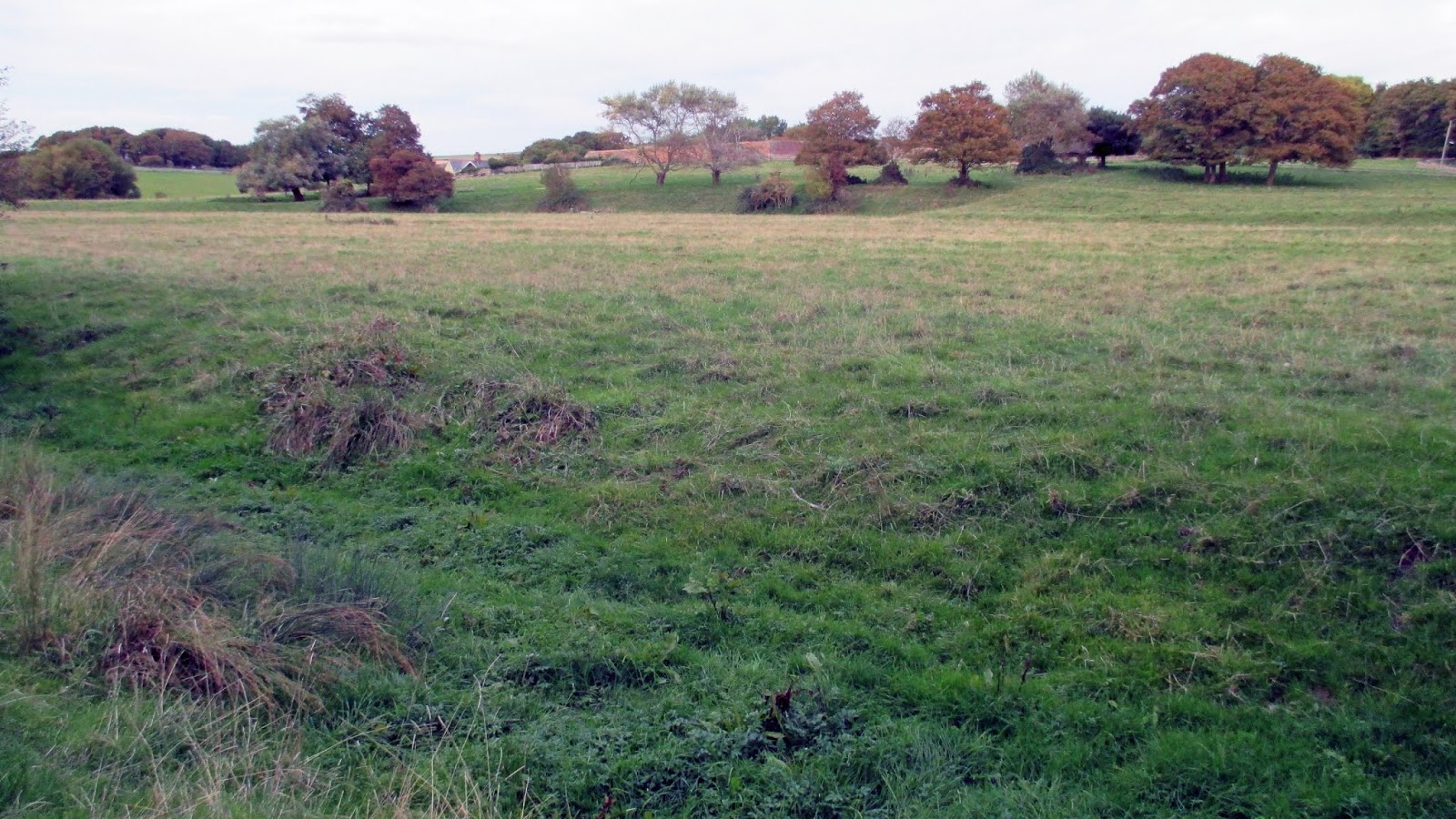
The artist Simon Lewty wrote that "the same walk can mean something different each time it is made, so that familiarity may not lead to contempt, but to renewed astonishment, as the known yields up the unknown"1. I felt renewed astonishment with my discovery of the relics of the old tidal harbour at Bishopstone, the scars of the old creek that run in a loop which joins the dots of five ponds in what is now a damp pasture. Countless times have I walked around this meadow and many times have I looked and wondered at its curious ditches and embankments, but always only in isolation and never before seeing it as a whole system, a system which carries downstream, away from the village and on towards The Buckle, beyond the causewayed coast road and Seaford branch line, beyond into the scars of the old Ouse, towards the sea.

The shallow cleft has been present every one of the thousand and more times I walked through the meadow, hiding in plain sight, unnoticed. Two hundred and seventy years ago I would have been waist-deep in ooze. Today it is a mere suggestion, fragmented into a necklace of damp hollows and seasonal ponds, some not much more than big puddles distressed by cattle-hoof imprints which makes my own passage tiptoe teetering and treacherous. Events downstream repurposed this from a place of departure and return into a place where the twice-daily tidal heartbeat has slowed-slowed to a seasonal ebb and rise of wet and dry, winter and summer, watched over by the resident cattle and transient walkers and dog-walkers. The twice-daily tide has been reduced to a once-a-year event.

Today I choose to dwell a while, to trace the loop of the channel and chart a meandering course where boats once negotiated the shallows. Where once the flow would have scoured clean the channel, now there is a detritus of things stranded in space and time. The ruins of a concrete drain float on the surface, perhaps shattered by the seasonal heave of wet and dry ground. It could be a hundred year-old drainage improvement effort. There's a flotsam of wooden posts and planks that might have been fences or bridges that once spanned the channel. Glass bottles and flints from the decaying wall bob up and down in the shallows. After the hottest, driest summer in years, the ground here, where once redshanks called their melancholy ‘teu teu’, still remained damp enough to sustain a carpet of redshank - that dense matted flower of ditches and damp places. So the bird has become the flower.
I pause and listen to the birdsong: jackdaws and rooks and woodpigeons above, magpies, long-tailed tits, a chiff-chaff, greenfinches, a great spotted woodpecker. Creatures of the wood.  Where once rain would have fallen into the creek and flowed downstream, now a large beech – surely one of the Duke's beeches, planted after the water receded – rains its mast into the channel, slowly filling it. Two grey squirrels dart around its base where once grey mullet swam. A large owl nest box has been fixed to a sycamore trunk. I've never noticed it before, tucked away beneath the lowest boughs. Somewhere in the boughs above, the tawny owl calls as I discover this little secret of the wood’s edge. Perfect timing! To my right, low across the open meadow a sparrowhawk sweeps in attack. Then a grey heron glides in - that's more like it! And then a moment of eerie and wonderful splendour: the bubbling ripples of a curlew’s call, somewhere in the near distance, unseen but up there on shivering wings, the call ‘cour-lee’, truly a song of the heart.  The sound echoes through the trees with a moment's sustain, gaining in urgency: ‘troo-ee troo-ee trrroo-eee’. For a moment the air boils, then falls silent and they are gone. The ghosts of the old harbour are bubbling up through the ground like a wellspring and I have sunk knee-deep into its memory simply by pausing here for a few moments. This land is willing to yield its secrets to anyone who cares to ask.

The long wave of the last tide ebbed away from this place 250 or so years ago. The harbour may have gone extinct, but the wet never quite left - it has lingered as a half-memory, a half-remembered purpose it once held here, a shade or an imprint. The water haunts the meadow, benign in summer and autumn, resolute in winter and spring; the almost imperceptible year-long tidal ebb and rise. 
 
Global sea levels have risen by about 20cm since 18802. They are predicted to rise this century by about a further 65cm3, many studies suggest by as much as or even more than one metre, as oceans continue to thermally expand and as ice sheets melt. This rise might not revive the little harbour, but it would allow the water back in and restore it as a more dominant influence4. It might push people further from it and encourage the return of wading birds and wildfowl. The distant curlews' call may yet return here, but for now I have to walk on towards the Ouse floodplain to find them.

Sea level model following a sea-level rise of one metre


References
1.    Clifford, Sue and King, Angela (Eds.) (1996) From Place to Place: Maps and Parish Maps. London: Common Ground.
2.    US Global Change Research Program: Global Sea Level Rise https://www.globalchange.gov/browse/indicators/global-sea-level-rise (retrieved 02/10/18).
4.    http://www.floodmap.net/  (accessed 02/10/18).


The creek crosses the road at the dip
One of five ponds at Bishopstone
Damp hollow
Beech-mast raining into the old creek
Redshank (Persicaria maculosa)
The harbourside where boats moored?
Drainage hole in the wall...
...of the seasonal pool
The former harbourside?

Friday, 28 September 2018

Heartland Walks #2: Rookery Hill and Bishopstone


Ambiance: atmosphere, feel, setting, environment, mood, character, air, quality
Heartland: core, hub, nucleus, focus, centre, middle
Here: now, at this time/point/juncture
Locale: location, setting, place, milieu, area, locality, site, spot
Locality: area, neighbourhood, zone, vicinity, section, quarter, ghetto, district
Milieu: setting, environment, scene, background, situation, location, locale, ambiance
Neighbourhood: area, region, district, locality, zone, quarter, vicinity
Surroundings: environs, settings, environments, backgrounds, backdrops, atmospheres, ambiences
Vicinity: neighbourhood, district, locality, area, purlieu, locale


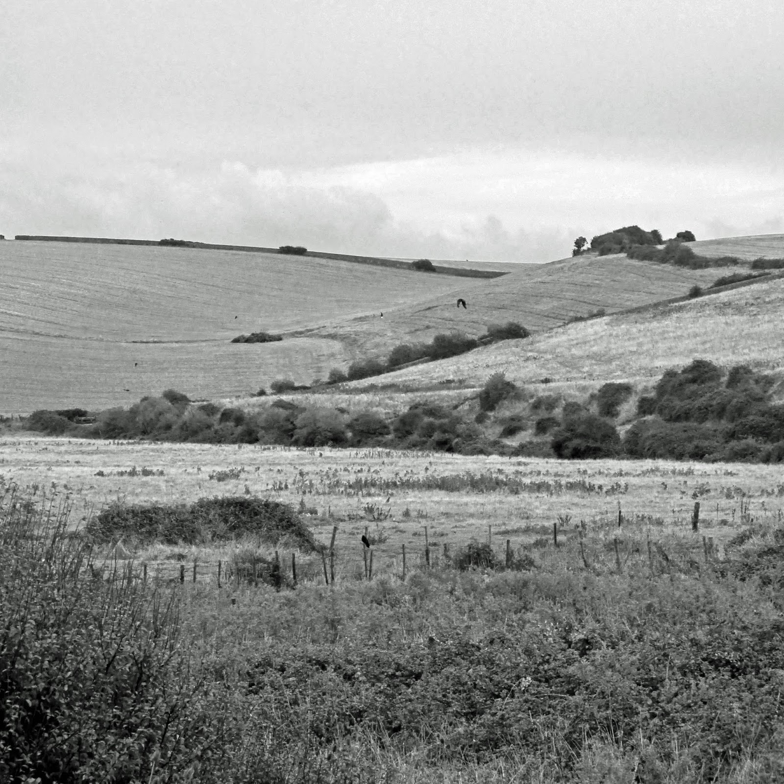
The rain is already close as Leo and I lock up and disappear into the weekend. The forecast predicts rain is still two hours off, but the dark phalanx of cloud marching eastwards suggests otherwise. The first spots are felt before we’ve walked a quarter of a mile and my wet weather gear is out and on as the curtain of rain washes over us. The ferry disappeared into it moments before and is gone, like disappearing into a waterfall. The wind is fidgety: a low breeze carrying the whiff of Newhaven’s industrial Saturday morning rises to a headwind, surfing the first enthusiastic rain wave, then settles back to near calm with the steady rain. We are crossing the chalk east ridge of the Ouse valley in search of the floodplain below. I have felt a growing appetite to watch and hear Curlew as they return from their upland nesting sites to coastal wintering grounds. We will explore the heartland of the Ouse floodplain. The tide is high and rising, so there is a good chance they will be sitting it out somewhere in or around the Ouse Estuary Local Nature Reserve. From a trig above The Rookery, the narrow ribbon of the Mill Drove shines wet and bisects the Tide Mills ruins. To its east the land stretches flat to the Buckle and curves inland through the old Pelham estate towards Bishopstone and its church sat slightly elevated above the once-marsh, where now a criss-cross of drains cut through damp meadows which still become a shallow wetland in winter. Curlews and countless other waders once would have piped the mudflats at low tide. Surrounding escarpment and steep ridges show where the tides would once have lapped up to twice-daily. This, then, shall be our starting point.

The road to the village at Bishopstone rises gently, so once over the stile built into the flint wall, one drops down into the floodplain below. A path into Bishopstone Wood - the Rookery - is a causeway between two ponds which dry out during good summers. Three other ponds lie nearby. They're alive with dragonflies then, but none are seen today as I pass towards the woodland edge. Great trees planted by Thomas Pelham-Holles, the Duke of Newcastle and twice Prime Minister, sometime after he inherited the land from his uncle in 1711, mark the boundary between the wood and pasture. They are outliving a decaying flint wall that follows the tree line and marks the route of Duke's Walk through the trees and up towards Norton Top. One of the largest sycamores I know stands over the corner with great vertical boughs reaching like outstretched fingers towards the sky. Its bark is thick with lichen-crusted scales. Elms and big beeches which may be nearly 300 years old mark the edge further up.

It takes a little imagination to see a harbour here with ships moored up, sailing between Rookery Hill and Hawth Hill to and from the river proper and the sea beyond, but this was once the scene. Perhaps the ponds are its last trace? To imagine this better, it is helpful to view the floodplain from Rookery Hill above. The hill was once a promontory bounded on three sides by the estuary. It has Bronze Age barrows and Romano-British and Saxon settlements which once looked across the tidal flats to neighbouring settlements on Hawth Hill and beyond across the floodplain to the sea. Much of this is buried beneath the bungalows of the Harbour View estate. The river followed an eastward course to the foot of Seaford Head until about 1567, and a ferry-boat operated at Bishopstone to transport people and livestock to and from the shingle spit and its road which stretched along the coast, beyond the parish of Sutton. In 1567 the river burst through the spit somewhere between what is now The Buckle and Tidemills. The channel beyond silted up and marked the end of Seaford as a Cinque Port. Only The Old Brickfield, The Salts and Martello Fields, the position of St. Leonard’s Church in the old parish of Sutton and the course of Steyne Road – steyne meaning a stony place – are physical hints of the old course of the river. Imagine the joy of being able to bypass the old port and its rules and taxes. Was there human agency involved with the change in the river’s course?

Later still, in the 1750s, a storm disturbed the shingle spit and the river broke through to the west at Meeching, soon to become the New Haven. Between these two events the floodplain at Bishopstone was a harbour. It’s fascinating to imagine ships moored where the seasonal ponds remain. Shapes in the ground today suggest banksides where the land rose out of the estuary. Water still influences this land, even if only as the dregs of its former glory.

Back below Rookery Wood, the lush grass and damp ground is no good for sheep grazing and a small herd of well-behaved cattle spends most of the year here and through the open gate leading into the field to the north, by the few houses. This land has lived different lives throughout history and the peaceful inertia of today may once have been rather more influenced by the tides and industry of the local people. This is a common theme that will recur as I walk south and then westwards through the floodplain. Standing now though in the once-estuary, where trees and pasture have replaced the wooden ships and their harbour, ripples of history can still be felt. The lowest levels are still inundated after the winter rains each year and the land is usually off limits during the early months. At these times it might even be navigable by boat.


Wednesday, 26 September 2018

Heartland Walks #1


The River Ouse and its floodplain is Newhaven's lifeblood. 
It is an in between land; a little-tamed, wild hinterland; the heartland. 
Everything flows from here.

Laying in bed at night I often hear a coarse purr rising from the port of Newhaven. It carries along on prevailing winds through the bedroom window. Our house overlooks the flat levels of the lower Ouse estuary, Newhaven’s heartland, sculpted by the migrating river as it snaked and carved its course through the millennia. The view stretches southwards to the sea and inland past the quays which line the river. Visible through a gap in houses opposite are damp pastures and arable fields surrounded by open drains, some of which may be remnant creeks that once snaked like eels through tidal mudflats, others dug in straight channels from the sixteenth century, when the river rediscovered its ancient route to sea by Castle Hill. The purring sound comforts me. Rather than disturbing or delaying my sleep, it ushers it on. It is the sound of home, of familiarity, of safety. I recall that same sound forty years ago when, as a child, laying in bed on the other side of town, it would purr its lullaby. I sometimes wonder whether the source is a discrete activity or just the sound of the town resting after a tiring day of work, its heartbeat.

The purr reveals a fact about the town: it is a place of work, where work is done. The narrow ribbon of quayside activity which lines the river has pulsed daily since the first fishing boats and barges carried goods to and from the port, inland to Lewes and beyond or along the coast, working around the tides. At any time today one could hear the deep bass roar of the ferry as it arrives and leaves or the crash of waste transfer stations, whirring roof-mounted fans and a thousand other sounds. But when the white noise settles down for the day, the purr is still there. Piecemeal  changes might mostly have gone unnoticed, yet the town has seen a multitude of activities come and go in this small parcel of land, some influenced by local need, others by the relentless march of progress, all punctuated by the repossession of those places by nature before it is again evicted for the next endeavour. The pulse of change seems to have quickened during recent decades. Decisions taken by a few people with narrow interests, inconsiderate of the wildlife and the town’s character, have attracted the townsfolk’s ire.

Not everyone is bothered. To wave away change as inevitable and legitimate is to miss a vital truth about any place. Sense of place is not really about the physical characteristics found on the surface geography; it is an intricate tapestry of things threaded into the collective memories and experiences of a population. It is temporal as well as spatial, geography of the collective mind, and it raises a further truth: how can it be expected that a developer or a town planner or anyone who does not share our rootedness understand the catastrophe of change in a place? To those naysayers who don't think so much of Newhaven’s wild heartland and its history, I offer the example of the current East Pier, which during the last 125 years or so has become a cherished feature within the town's character (an east pier of some sort has been there since about 1670, by the way). There are memories surrounding the pier. There was the occasion of the steam dredger, surrounded by the town’s fishing fleet as it dredged silt, fish and shellfish alongside the pier. I imagine it every time I walk along the East Side beach at low tide and find the shells of Mactra stultorum, the Rayed Trough Shell, resting on the sand, where its community still siphons mud at the river’s mouth as it must have since the river first cut its way through to the sea here. Purple Sandpipers sit out the high-water on the little pier and wait for the tide-washed parts of its skeleton to be revealed. Many birdwatchers have told me this is where they first saw a Purple Sandpiper. Fishermen cast their lines today in the same arc as previous generations, hoping to lure the fish which follow the tide out and in. Eric Ravilious painted the pier on several occasions from the quayside or from his room at The Hope Inn. People once waved off little boats from the pier as they sailed out to rescue troops stranded at Dunkirk.  These stories are etched into the heart of the town’s identity and the hearts of the townsfolk.

The east pier is nearing the end of its time, soon to be replaced by a deep water berth and the protective embrace of a new sea arm, which no doubt will itself find its way into our hearts. Many locals will mourn the passing of the old pier though. The upset is caused not so much the harsh fact of change, but more as a result of many small acts of vandalism, this one included, which corrode Newhaven's character. These are irreversible acts occasioned upon us, the locals. No developer or decision-maker will consider the cumulative impact of these acts upon us, or care about where the sandpipers will be displaced to, or even whether the impact upon the ray shells will be catastrophic. They won't care if they bury beneath tonnes of aggregate the place where we once sat on sandy towels with long departed loved ones, or where a couple had their first kiss. These things have no value to them, only us. We are the ones who mourn the loss of these things, the familiar patterns of place. Our map – the one in our collective consciousness – has depth and emotion which is lacking from the physical, unsentimental statement of ownership spread across the developer’s desktop. Rather than sharing a cold geography, we are in fact a series of diverse threads embroidered into a psychogeography which forms an intimate knowledge and shared sense of community.

Change can be positive when it is made considerately, but it is important to remember and provide witness to past changes in order to inform how best to do it now and in future - to place them in a collective memory, where experience and feeling take precedent above physical geography. In this way we can be agents of positive change tomorrow by knowing what is important today and yesterday. As the shadow of change now looms over parts of this heartland and I am denied the right to explore familiar places once accessible, I resolve to explore this small hinterland between The Buckle and Newhaven’s East Quay and inland to the Drove and beyond to the most northerly influence of the town, keeping to the floodplain all the way. I'm interested in the Seahaven hinterland and the blurred line of where Seaford ends and Newhaven begins. This line has shifted with the course of the river throughout history. Seahaven is the perfect compromise. This is no wasteland, no forgotten place; it is the artery, the lifeblood. It is its energy which has made it difficult to be tamed by people. Natural processes have shaped this land above any other influence and created what we see and walk upon today. I will try and collect a snapshot – a word-map – of this place as I find it now and as we have known it and placed it on display in our collective memory.

The purring sound drifting through my open window over from the port may one day cease. It might be drowned out by the acoustic creep of industry. It might be replaced by another familiar noise. Its passing may not be noticed, but its lullaby may be remembered when its absence disturbs my sleep.